

Published: 10:34AM Sunday March 15, 2015
The North Island is bracing for Cyclone Pam, with heavy rain and gale-force winds forecast for northern and eastern areas of the island.
MetService has issued a Severe Weather warning for northern and eastern parts of the North Island, where heavy rain and south to southeast gales are expected from this evening (Sunday) through to Tuesday.
5.34pm: Auckland Transport says Gulf Harbour ferry services have been cancelled tomorrow morning due to the expected high winds. Buses will replace the scheduled services. The service from Pine Harbour at 7.20am will also be replaced by a bus leaving at 7.40.
A decision will be made on some other ferry services early tomorrow morning.

Preparation for Cyclone Pam at Mount Maunganui included moving a 19-year-old Pilot Bay piano from its home in one garage to another garage on higher ground along Commons Ave
5.14pm: At least eight people are confirmed dead in Vanuatu after the massive cyclone and the death toll is likely to rise much higher once communications are restored with outlying islands, aid workers say.
Chloe Morrison, a World Vision emergency communications officer in Port Vila, says officials from Vanuatu's National Disaster Management Office confirmed to her agency that at least eight people died in and around the capital, Port Vila.
Officials have yet to assess the damage in many of the hard-hit outer islands because communications and power remain cut, she says. Ms Morrison says she has heard reports of entire villages being destroyed in more remote areas.
4.45pm: Health is emerging as a major concern in Vanuatu where power outages have hit the main hospital after Cyclone Pam which is feared to be one of the region's worst natural disasters.
Oxfam Country Director in Port Vila, Colin Collet van Rooyen, says this not only affects patient care but also temperature-sensitive medications and vaccines, which need refrigeration.
Mr Collet van Rooyen says it was one of the problems that came up at a meeting between the High Commissioners of Australia and New Zealand and Vanuatu's high levels of government at the National Disaster Management Office today.
Water sanitation and hygiene at the shelters as well as the need for temporary mortuary facilities also emerged as major concerns at the meeting, Mr Collet van Rooyen said. Plans around co-ordinated aid and recovery are expected to be announced shortly.
4.11pm: Vanuatu's Government has declared a state of emergency for the cyclone-battered country.
There are six certain deaths in Port Vila and 20 casualties, Vanuatu National Disaster Management Office spokesman Paulo Malatu told news agency AFP.

People scour through debris damaged and flung around in Port Vila, Vanuatu, in the aftermath of Cyclone Pam
3.57pm: The north-east coast of Auckland and Great Barrier Island will be hit by severe weather this evening and general disruption is expected across the region, Civil Defence says.
Civil Defence Controller Clive Manley says Aucklanders are advised to exercise extreme caution. Areas north of Whangaparaoa and Great Barrier have a good chance of river and stream flooding, strong winds, large swells, waves and coastal erosion, he says.
If possible Aucklanders should reconsider their travel plans and work from home or delay their travel time to avoid expected traffic disruption tomorrow morning, he says.
Surface flooding and slips is likely to make driving difficult from tonight until Tuesday. There may also be local power cuts. People in affected areas should have a battery-powered torch, radio, food, water and other essentials. Light rain has been falling in Auckland since around 3.30pm.
3.38pm: Civil Defence in Bay of Plenty advises sandbags have been made available for collection for residents in areas prone to flooding in Whakatane and Mt Maunganui. Residents can fill the sandbags and block entrances to garages etc which have flooded in the past.
Warnings from BoP Civil Defence remain:
- Between 120-160mm of rain expected over 24 hr period from tonight.
- Of concern are the very high winds that are also forecast.
- Residents are advised to secure properties - especially outdoor furniture and anything else that could blow around.
- Clean out gutters and drains.
- Stay off the roads and avoid unnecessary travel.
- Be sensible.
3.07pm: Save the Children says six people have died in Port Vila, Vanuatu's capital, and many more from the country's remote islands - where shelter is extremely limited - are feared to have lost their lives.
Save the Children's teams on the ground have been visiting evacuation centres and trying to reach villages on the coast to assess the damage.
"We're extremely concerned about communities who live close to the ocean. We still can't access many of them because of the flood waters," says Nichola Krey, Save the Children's Head of Humanitarian Response who's on her way to Vanuatu.
"These communities are very poor and their homes are made from scrap materials. We fear many villages have been swept away in the huge storm swell."

People on a dock view yachts damaged in Port Vila, Vanuatu, in the aftermath of Cyclone Pam
2.55pm: More than 70 firefighters and 30 appliances and other specialist vehicles are moving into vulnerable North Island coastal areas as Cyclone Pam approaches the country.
Fire Service Deputy National Commander Paul McGill says deploying resources now will provide extra support for local crews and allow personnel to get into position in areas likely to be cut off by flooding.
The Fire Service is moving taskforces to Northland, eastern Bay of Plenty, Hawke’s Bay and Poverty Bay.
McGill says firefighters will provide as much assistance as possible to local communities. This is likely to include helping people isolated by flooding and slips or stuck in vehicles, pumping out flooded buildings, salvage work and securing damaged buildings.
2.35pm: Australia will provide a "life-saving" package of $A5 million and humanitarian supplies to help Vanuatu. Foreign Minister Julie Bishop says the commitment follows a request from the Vanuatu government. "This package will include $A5 million that will be provided to Australian NGOs, particularly the Red Cross and to other United Nations partners," she told reporters in Perth.
"We will also be deploying humanitarian supplies to provide support for up to 5,000 people in the form of water, sanitation and shelter." A team of medical experts and urban search and rescue personnel will also be deployed.
1:25pm: The Auckland Fire Service has sent a "taskforce", comprising of 12 firefighters and four vehicles, to Northland.
They’re tasked with helping local volunteer brigades, if needed, when Cyclone Pam hits.

1:04pm: Brent Stewart of Eastland Group says crews and contractors are poised and ready to act should high winds cause power outages in Gisborne.
Crews are also on standby in other neighbouring areas should they need to be brought in and assist.
The possibility of high winds blowing trees down on power lines is the biggest concern at the moment.
Meanwhile, Pak'N'Save in Gisborne has been inundated with residents buying emergency supplies like water, candles and batteries.

Cyclone Pam weather graphic
12.46pm: Up to 90% of housing in Vanuatu's capital is reported to have been seriously damaged by Cyclone Pam, with still no information from the extremely vulnerable outer islands which are home to over 30,000 people.
Oxfam Country Director in Port Vila, Colin Collet van Rooyen said today while six deaths have been confirmed this number is likely to climb once communities across the archipelago are reached.
"This is likely to be one of the worst disasters ever seen in the Pacific," he said.
"Entire communities have been blown away."
Oxfam has a team on the ground and more humanitarian response experts attempting to travel there today.
Mr Collett van Rooyen said immediate priorities in Vanuatu would be to provide shelter, clean water and sanitation to people, especially those left homeless. Temporary toilets, water purification tablets, soap and water containers would all be vital, he said.

11:23am: A plane loaded with nearly 10 tons of food, water and first aid kits has left Auckland for Port Vila.
Hercules flight commander Leigh Foster says the plane will land at Port Vila Airport where the runway is open for military operations only.
10:34am:
10:30am: Civil Defence says Northland appears set to be spared the worst of the remains of Cyclone Pam but officials are still warning of severe gales and heavy rain this afternoon and overnight.
They say motorists should postpone any unnecessary travel from midday today until tomorrow morning.
Ref:http://tvnz.co.nz/national-news/live-updates-cyclone-pam-arrives-in-nz-evening-6255440
The North Island is bracing for Cyclone Pam, with heavy rain and gale-force winds forecast for northern and eastern areas of the island.
MetService has issued a Severe Weather warning for northern and eastern parts of the North Island, where heavy rain and south to southeast gales are expected from this evening (Sunday) through to Tuesday.
5.34pm: Auckland Transport says Gulf Harbour ferry services have been cancelled tomorrow morning due to the expected high winds. Buses will replace the scheduled services. The service from Pine Harbour at 7.20am will also be replaced by a bus leaving at 7.40.
A decision will be made on some other ferry services early tomorrow morning.
Preparation for Cyclone Pam at Mount Maunganui included moving a 19-year-old Pilot Bay piano from its home in one garage to another garage on higher ground along Commons Ave
5.14pm: At least eight people are confirmed dead in Vanuatu after the massive cyclone and the death toll is likely to rise much higher once communications are restored with outlying islands, aid workers say.
Chloe Morrison, a World Vision emergency communications officer in Port Vila, says officials from Vanuatu's National Disaster Management Office confirmed to her agency that at least eight people died in and around the capital, Port Vila.
Officials have yet to assess the damage in many of the hard-hit outer islands because communications and power remain cut, she says. Ms Morrison says she has heard reports of entire villages being destroyed in more remote areas.
4.45pm: Health is emerging as a major concern in Vanuatu where power outages have hit the main hospital after Cyclone Pam which is feared to be one of the region's worst natural disasters.
Oxfam Country Director in Port Vila, Colin Collet van Rooyen, says this not only affects patient care but also temperature-sensitive medications and vaccines, which need refrigeration.
Mr Collet van Rooyen says it was one of the problems that came up at a meeting between the High Commissioners of Australia and New Zealand and Vanuatu's high levels of government at the National Disaster Management Office today.
Water sanitation and hygiene at the shelters as well as the need for temporary mortuary facilities also emerged as major concerns at the meeting, Mr Collet van Rooyen said. Plans around co-ordinated aid and recovery are expected to be announced shortly.
4.11pm: Vanuatu's Government has declared a state of emergency for the cyclone-battered country.
There are six certain deaths in Port Vila and 20 casualties, Vanuatu National Disaster Management Office spokesman Paulo Malatu told news agency AFP.
People scour through debris damaged and flung around in Port Vila, Vanuatu, in the aftermath of Cyclone Pam
3.57pm: The north-east coast of Auckland and Great Barrier Island will be hit by severe weather this evening and general disruption is expected across the region, Civil Defence says.
Civil Defence Controller Clive Manley says Aucklanders are advised to exercise extreme caution. Areas north of Whangaparaoa and Great Barrier have a good chance of river and stream flooding, strong winds, large swells, waves and coastal erosion, he says.
If possible Aucklanders should reconsider their travel plans and work from home or delay their travel time to avoid expected traffic disruption tomorrow morning, he says.
Surface flooding and slips is likely to make driving difficult from tonight until Tuesday. There may also be local power cuts. People in affected areas should have a battery-powered torch, radio, food, water and other essentials. Light rain has been falling in Auckland since around 3.30pm.
3.38pm: Civil Defence in Bay of Plenty advises sandbags have been made available for collection for residents in areas prone to flooding in Whakatane and Mt Maunganui. Residents can fill the sandbags and block entrances to garages etc which have flooded in the past.
Warnings from BoP Civil Defence remain:
- Between 120-160mm of rain expected over 24 hr period from tonight.
- Of concern are the very high winds that are also forecast.
- Residents are advised to secure properties - especially outdoor furniture and anything else that could blow around.
- Clean out gutters and drains.
- Stay off the roads and avoid unnecessary travel.
- Be sensible.
3.07pm: Save the Children says six people have died in Port Vila, Vanuatu's capital, and many more from the country's remote islands - where shelter is extremely limited - are feared to have lost their lives.
Save the Children's teams on the ground have been visiting evacuation centres and trying to reach villages on the coast to assess the damage.
"We're extremely concerned about communities who live close to the ocean. We still can't access many of them because of the flood waters," says Nichola Krey, Save the Children's Head of Humanitarian Response who's on her way to Vanuatu.
"These communities are very poor and their homes are made from scrap materials. We fear many villages have been swept away in the huge storm swell."
People on a dock view yachts damaged in Port Vila, Vanuatu, in the aftermath of Cyclone Pam
2.55pm: More than 70 firefighters and 30 appliances and other specialist vehicles are moving into vulnerable North Island coastal areas as Cyclone Pam approaches the country.
Fire Service Deputy National Commander Paul McGill says deploying resources now will provide extra support for local crews and allow personnel to get into position in areas likely to be cut off by flooding.
The Fire Service is moving taskforces to Northland, eastern Bay of Plenty, Hawke’s Bay and Poverty Bay.
McGill says firefighters will provide as much assistance as possible to local communities. This is likely to include helping people isolated by flooding and slips or stuck in vehicles, pumping out flooded buildings, salvage work and securing damaged buildings.
2.35pm: Australia will provide a "life-saving" package of $A5 million and humanitarian supplies to help Vanuatu. Foreign Minister Julie Bishop says the commitment follows a request from the Vanuatu government. "This package will include $A5 million that will be provided to Australian NGOs, particularly the Red Cross and to other United Nations partners," she told reporters in Perth.
"We will also be deploying humanitarian supplies to provide support for up to 5,000 people in the form of water, sanitation and shelter." A team of medical experts and urban search and rescue personnel will also be deployed.
1:25pm: The Auckland Fire Service has sent a "taskforce", comprising of 12 firefighters and four vehicles, to Northland.
They’re tasked with helping local volunteer brigades, if needed, when Cyclone Pam hits.
1:04pm: Brent Stewart of Eastland Group says crews and contractors are poised and ready to act should high winds cause power outages in Gisborne.
Crews are also on standby in other neighbouring areas should they need to be brought in and assist.
The possibility of high winds blowing trees down on power lines is the biggest concern at the moment.
Meanwhile, Pak'N'Save in Gisborne has been inundated with residents buying emergency supplies like water, candles and batteries.
Cyclone Pam weather graphic
12.46pm: Up to 90% of housing in Vanuatu's capital is reported to have been seriously damaged by Cyclone Pam, with still no information from the extremely vulnerable outer islands which are home to over 30,000 people.
Oxfam Country Director in Port Vila, Colin Collet van Rooyen said today while six deaths have been confirmed this number is likely to climb once communities across the archipelago are reached.
"This is likely to be one of the worst disasters ever seen in the Pacific," he said.
"Entire communities have been blown away."
Oxfam has a team on the ground and more humanitarian response experts attempting to travel there today.
Mr Collett van Rooyen said immediate priorities in Vanuatu would be to provide shelter, clean water and sanitation to people, especially those left homeless. Temporary toilets, water purification tablets, soap and water containers would all be vital, he said.
11:23am: A plane loaded with nearly 10 tons of food, water and first aid kits has left Auckland for Port Vila.
Hercules flight commander Leigh Foster says the plane will land at Port Vila Airport where the runway is open for military operations only.
10:34am:
Severe damage to Vila Central Hospital in Vanuatu #CyclonePAM Pics via Dr. Trevor and Val Samson pic.twitter.com/S5o8gw7z59
— 28storms.com (@28storms) March 14, 2015
10:30am: Civil Defence says Northland appears set to be spared the worst of the remains of Cyclone Pam but officials are still warning of severe gales and heavy rain this afternoon and overnight.
They say motorists should postpone any unnecessary travel from midday today until tomorrow morning.
Ref:http://tvnz.co.nz/national-news/live-updates-cyclone-pam-arrives-in-nz-evening-6255440


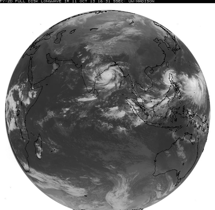
 This satellite image of Typhoon Matmo, courtesy of NOAA, was taken Tuesday night, local time.

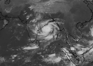
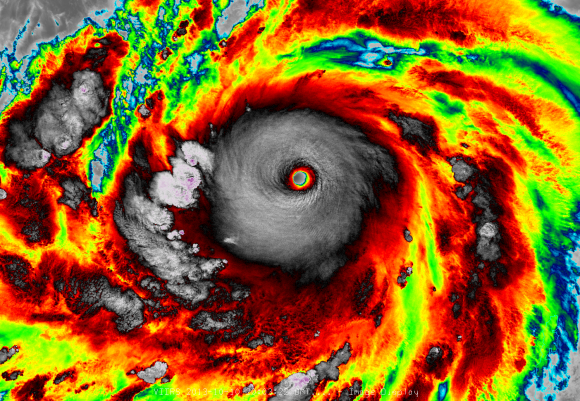
 Super Typhoon Haiyan is seen approaching the Philippines in this Japan Meteorological Agency handout image taken on Thursday. Photo: Reuters/Japan Meteorological Agency
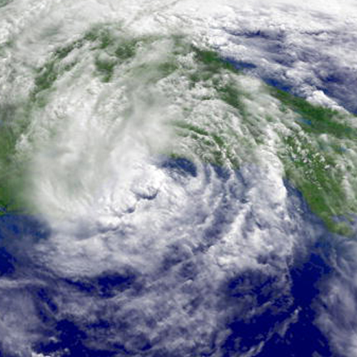

.gif)


