October 11, 2013, 1900 UTC (2 p.m. CDT).
Cyclone Phailin is a major hurricane (specified as a Super Cyclonic
Storm) with wind speeds at 160 miles per hour, making it a Category 5
storm on the Saffir Simpson scale. The storm is not projected to weaken
much as it slams into parts of eastern India late Saturday according to
Indian clocks (Saturday morning U.S. time). The last time a Category 4
or 5 storm struck the eastern coast of India was back in 1999, when
Cyclone Odisha struck killing over 10,000 people. A major disaster
appears to be in the making, with at least one Indian meteorologist
commenting that Phailin has the potential to be “worse than Katrina.”
Indeed, Phailin has the potential to be one of the deadliest storms
on Earth for the past several decades. Phailin is expected to make
landfall in northeast India, approximately between Visakhapatnam and
Puri, within the next 24 hours.
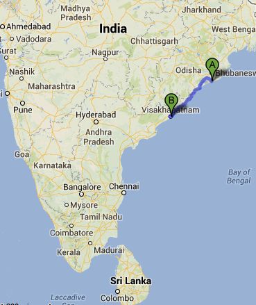
Cyclone
Phailin is expected to strike the eastern coast of India, between the
two points marked on this map. “A” is Puri, a holy city of the Hindus
and popular tourist resort. “B” is the port city of Visakhapatnam,
sometimes called The Jewel of the East Coast.
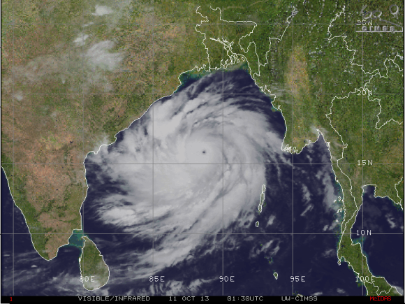
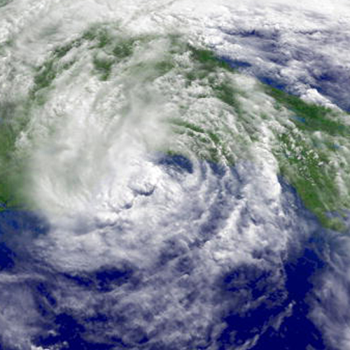
Cyclone Phailin on October 10, 2013. Some media are describing it as “half the size of India.” Image via CIMSS
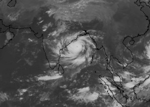
Cyclone Phailin. Image Credit: Cooperative Institute for Research in the Atmosphere
Cyclone Phailin is currently spinning away in the Bay of Bengal. It
is a large cyclone and is almost covering up nearly all of the Bay of
Bengal. The last time a Category 4 or 5 storm struck the eastern coast
of India was back in 1999, when Cyclone Odisha struck killing over
10,000 people. The residents that live off the coast of India are
vulnerable to storm surge, flooding, and extreme damage from tropical
cyclones. If you throw into the mix a Category 4 or 5 storm, that spells
major problems. The storm is super large, meaning storm surge will
likely be greater.
Phailin has already had an eyewall replacement cycle, meaning that it
could intensify prior to making landfall in eastern India. The storm is
very symmetric and is going over very warm waters and perfect
atmospheric conditions that are very favorable for an intensifying
storm.

Forecast track of Cyclone Phailin. Image Credit: Joint Typhoon Warning Center
Cyclone formation in the Northern Indian Ocean is typically a rare
event. That part of the world usually sees 3 to 6 systems per year.
Since 2000, the Bay of Bengal averages roughly two cyclones each year.
Some of the most active years in the Northern Indian Ocean occurred in
the 1970s when the basin averaged roughly five storms each year. 1998
and 1999 were active seasons that each had 3 storms make landfall in
India with two of them at hurricane intensity (64 knots or 74 mph or
stronger). According to
Jeff Masters from Weather Underground,
26 of the 35 deadliest tropical cyclones in world history have been Bay
of Bengal storms. Also, 42% of Earth’s tropical cyclone-associated
deaths have occurred in Bangladesh.
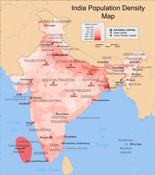
India
is the second most populated country in the world with a high
percentage along the northeast and eastern coast of India. Image Credit:
Wikipedia
India is vulnerable to tropical cyclones. According to Dr. Marshall
Shepherd, President of the American Meteorological Society and Professor
at the University of Georgia, we have to focus on how communities are
vulnerable to weather extremes.
Vulnerability is a function of the disaster itself (e.g.
storm strength), the socio-economic vulnerability of those affected, and
the adaptive capacity or resilience of those affected. Many of the 40
million people in the path of Phailon have are highly socio economically
vulnerable with low adaptive capacity = human disaster. Katrina or
Andrew times a factor of perhaps 100 or more…
India is already evacuating and preparing for Cyclone Phailin.
However, the outer rain bands of the storm is already over land, and the
weather is expected to continue to deteriorate. Storm surge of 20 feet
or higher is possible. Flooding is very likely as the system is very
large. This storm will likely be extremely devastating for their economy
along the coast.
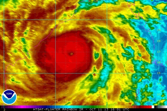
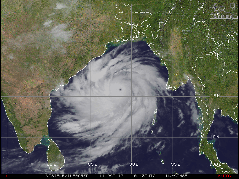
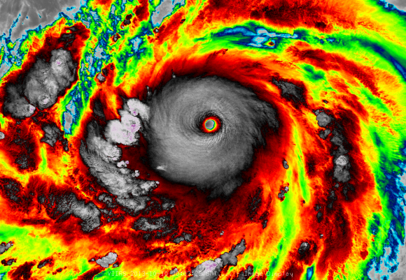
Cyclone Phailin on October 11, 2013. Image via NOAA
Bottom line: Cyclone Phailin is an extremely dangerous storm that is
going to hit the eastern coast of India within the next 24 hours as a
high end Category 4 or Category 5 storm. The last time a storm of this
intensity hit this region, over 10,000 people died. Conditions will
continue to deteriorate over the next 24 hours as the storm brings 150+
mile-per-hour winds, storm surge greater than 20 feet (6 meters), and
significant flooding. I wish there was good news to share, but this
setup looks almost catastrophic. Prayers go out to those affected by
this storm.
http://earthsky.org/earth/super-cyclonic-storm-phailin-extremely-dangerous-for-india